Showing posts with label Sea and beach. Show all posts

Sunday, 1 November 2015

Wild Postcards from Sri Lanka


An unedited version of my story published in the November 2015 edition of the in-flight magazine, JetWings


I furrow my brows, as the ringtone interrupts my hectic deadline. The number displayed on my mobile is unknown, but I continue to stare – something about it beginning with +94 seems deliciously familiar. I answer. Silence. Just as I return to furiously typing out the remainder of my email, it rings again. I absently answer the call, only to be greeted by rapid-fire talk in a language I don’t understand. Then it comes back to me, rusty as the memory is, from months of disuse. I get up from my chair, smile at no one in particular, and say “ayubowan.” The relentless chatter pauses. “No Sinhala,” I continue, like I’d repeated for three weeks, many months ago. The voice begins talking in an endearingly halting and lilting Hindi, “Main Prasanna bol rahaa hoon.” I can hear a smile, a shy smile. “Aapka letter aaya.” Instantly, my deadline is all but forgotten.

Sinharaja Forest Reserve, in south-west Sri Lanka, is the country’s only surviving primary tropical rainforest. Its pin-head size belies the fact that more than 60% of the flora and fauna found here are endemic to the region. Due to this high endemism, the forest has been declared a UNESCO heritage site.


Prasanna was my eyes and ears in Sinharaja, where the earth was as slippery as grease, and battalions of leeches clung to every human who dared brave the incessant rains. The sky flickered between innumerable shades of grey, and could barely be glimpsed through small gaps in the tall, dense rainforest canopy. The highlight of my trek was witnessing a mixed-flock hunt, with raucous drongos, frisky babblers, belligerent Blue Magpies, and even the dignified trogon, feasting on worms and insects emerging from the rain-battered earth. The forest trail yielded birds, fungi, flowers, snakes, and lizards of such varieties, that we were constantly surprised at every turn; even the endangered Purple-faced Leaf Monkey revealed itself on my last evening at Sinharaja.


At the end of each tiring day in the forest, I’d return to my room at Martin’s Simple Lodge, a place which is exactly as its name suggests, swapping sightings and experiences with fellow birding enthusiasts while savouring refreshing tea on the terrace overlooking Sinharaja’s dipterocarps, or while nonchalantly plucking leeches off our persons by the communal tap. The owner, a former guide and a wealth of information, is a man of few words; what makes him smile though, is visitors’ childlike enthusiasm at having seen a Red-faced Malkoha or a Ceylon Frogmouth up-close, in the forest he holds dear.


"Sinharaja’s villages don’t have pin-codes; how will my letter be delivered?" I’d asked, while saying goodbye. Prasanna just smiled, answerless. I needn’t have worried: the letter, along with photographs of Sinharaja, had reached him within a week of my convincing my neighbourhood post office that I was not ‘wasting eighty rupees in postage’.

“There is an error in your identification” Prasanna says, alluding to the contents of my letter, “This is a Purple-faced Leaf Monkey, not a Bear Monkey.” I apologise sheepishly for my rookie mistake. The mention of the Bear Monkey, though, swings me along to another place, another day.

Horton Plains National Park, located in Sri Lanka’s central highlands, is the country’s only montane grassland and cloud forest. Due to its high elevation, fog and clouds deposit a large amount of moisture, creating a unique ecosystem of moist grasslands, swamps and wetlands. The endemic flora and fauna have evolved to suit this peculiar habitat. Ohiya is a convenient base for exploring Horton Plains. However, due to extremely limited accommodation here, most visitors prefer to stay at the popular hill station Nuwara Eliya, almost two hours away.


The mountain railway at Ohiya snakes through dense foliage, from which peek colourful tin roofs. An occasional curlicue of smoke from a cooking fire is the only sign of habitation. Hiking along the tracks brought well-preserved, century-old sleepers and metal components my way. I was also rewarded with an encounter with the endemic Bear Monkeys, cousins of the species in Sinharaja. Over twenty of them, jumping from branch to branch, with a wary eye on me, looking improbably like monkeys with bear ancestors - to think, I wasn’t even within the national park boundary yet!


At Horton Plains National Park, the 9 kilometre trail meandering across grasslands, seasonal ponds, over undulating rock, sometimes gravel, and finally through dense forest, can be completed in 3 hours. However, stopping to admire bright orchids and gnarly trees, while looking for Bear Monkeys and elusive birds, meant that my trekking time doubled. My guide and I trekked anti-clockwise, beginning at the grasslands, moving on to Baker’s Falls, Large and Little World’s Ends, and finally, through dense vegetation. 

Old-man’s beard, a characteristic of Horton Plains, festooned all the trees in the last stretch, whose trunks and branches were also decorated with lichen and moss. A Sri Lankan breakfast of rotti, jam, and bananas, devoured while staring into World’s End, added to the air of fulfillment and quiet contemplation; the sheer escarpment here offers views till the coastline, on one of the rare clear days like that day.

I sigh, looking at the digital clock on my computer screen. The sun has long set, and I’ve been caught up in Sinharaja and Horton Plains. A flick of the switch illuminates the room. The paperwork on my desk lies un-tackled, held down by a pebble, smooth and rounded, as grey as the sea was that day. With white specks, as white as the sand looked, reflecting the sun’s generosity beating down on it. There I go again, carried along by a wave of memories.


Mirissa, a tiny fishing village in southern Sri Lanka, attracts visitors for two reasons: its laidback, picturesque beach and its whale-watching trips. Since it lies at the southernmost tip of the entire Indian subcontinent, whales migrating east to west must cross Mirissa. The abundance of food in the Indian Ocean makes it a favourite with these cetaceans, and even the otherwise-elusive Blue Whales and Sperm Whales are routinely spotted.  


At 5:30 am one morning, travellers gathered at the whale-watching agency’s office, upbeat at the prospect of guaranteed sightings of whales and dolphins. I, however, couldn’t bring myself to ignore the knot in my stomach, as I don’t take well to open seas. On the two-decked boat, all around me was laughter, anticipation and colourful life-jackets. The tantalising omelette station on board was crowded; just an hour later, the boat’s only restroom would be; so too the railing on the deck, with nauseous travellers bent over. Despite having resolutely stayed away from breakfast, I could feel my innards churning - quite an indication of the roiling Indian Ocean.

By the time we returned to shore after six hours at sea, we had become a statistic – the only boat in forty days to not sight a single whale. I held on to precious, fleeting memories of the dolphin pod we had seen, unfortunately far enough to look merely like grey flotsam. The next afternoon, travellers were agog at having spotted multiple whales. One had even breached the water, excited voices told us. All I could do was close my eyes and picture it, the waves lashing Mirissa’s beach adding sound to my thought. I smiled, as my imaginary Blue Whale emerged from bluer waters, magnificence personified. For this, I will brave the Indian Ocean again someday, I decided, sanguinely.   

“Wapas aaoge tab milenge” is Prasanna’s parting shot. He knows Sri Lanka’s allure – you just MUST return.  Sometimes, that’s all it takes to travel in time – a call you hesitated to take.


Saturday, 31 May 2014

Juggling Identities


An unedited version of my story published in the June 2014 edition of Outlook Traveller

The temple bells toll in the distance: a distinct, metallic clang of bronze.  “What a trendy bikini,” I think, as two girls walk past, suddenly rendering my swimsuit woefully out-of-fashion. Nearing sunset, the sea now resembles molten lava. I hear a yoga mat being dusted. I look up to see its owner - a middle-aged Caucasian with long, shocking-white hair and beard, tanned like a carrot from the sun, sporting rudraksha beads and aviators – done with his yoga for the day. My mobile rings: my auto driver says he’s waiting for me at the top of the hillock. If I want to see the evening aarti, I’d need to leave right away. I polish off the last slice of my Hawaiian pizza and gulp down my drink. Half an hour later, I join a snaking queue outside the crowded Mahabaleshwara temple. The heady fragrance of jasmine fills the air, occasionally mixed with the stench of cow dung, as cows sporadically relieve themselves. The bells toll even louder now, and people fold their hands in devotion, chanting prayers, occasionally crying out the lord’s name. Suddenly, the queue begins to frantically compress and shove; the door to the sanctum has just been opened. 

A cow ponders worldly matters at Om beach, un-distracted by revellers. The name Gokarna means ‘cow’s ear’ and has a mythological story to back it.

One of Gokarna's quirky residents.
A couple of days ago, driving into Gokarna, the highway gradually narrowed until my car got stuck trying to enter a crowded, one-car-width road. As I inched ahead, panic-stricken, the human tide parted to make way, squeezing between my car and open gutters on either side of the road. I was afraid somebody would fall in or that another vehicle would come along. The road did slightly widen after a while. Another vehicle did drive past. Gutters continued lining the road. The swarm of people remained. Yet, we all squeezed in to fit into that road. That’s what Gokarna is all about – coexistence.

By the time I drove on, took an incredibly difficult turn into an even narrower road to my guest-house, slipped on omnipresent cow dung and almost fell into a gutter, I was ready to leave. I only stayed because I was too scared to drive out again. Yet here I was, walking a couple of days later, seasonedly squeezing myself between a  car and the dreaded gutter, making way for somebody else’s arrival into Gokarna.

A typical Brahmin house


If Gokarna were a person, it would’ve been dubbed schizophrenic; it has two facets – a pilgrimage centre drawing hordes of devotees, and beaches attracting equal droves of flower-children. The former is called Gokarna Town while the beaches are simply known as Gokarna. The town was a bastion of orthodox Brahmins, until it began attracting hordes of non-Indian visitors seeking spirituality, yoga, meditation, and its many virgin beaches. Today, almost half the people seen in Gokarna are foreigners.

An aerial view of Kudle beach, with Om beach around the
cliff to the left and Gokarna beach around the cliff
to the right.
 
An aerial view of Om beach
For most visitors, their holiday begins and ends at the beaches. Most pilgrims confine themselves to the temple town. Both are neatly separated by a series of hillocks. Only one beach straddles that gap: Gokarna beach. Accessible by a short walk from the temple, this is where pilgrims unwind at the end of their temple visit; the women bashfully dip their toes in the water, while the men and children let loose. This beach is also where rituals for last rites are performed; Gokarna, aka Dakshin Kashi, is considered one of India’s seven holiest ‘places of salvation’. On the very same beach, you sometimes find beach bums who have strayed a bit too far from neighbouring Kudle beach, a part of the ‘beach Gokarna’ side. I, in fact, was attempting to straddle the divide in my own way: I’d chosen to stay in the town and visit the beaches from there. 

Beach-bums walk the rocky promontory from Om beach to Half-moon beach, even as a person meditates under a coconut tree at sunset.

Om Beach is popular with locals and visitors alike. And, with bovines too. 
Very little gives away the fact that Kudle beach is located in a temple town: tourists sun-bathe, play frescobol, canoe, swim in the clean, blue waters, or idle in one of the many shacks. Om Beach on the other hand, is popular with pilgrims too, attracted by its shape – an inverted Om - a religious symbol. This lends it an air of virtuous fun, preferred by families trying to avoid the possible culture-shock at Kudle beach. Boats moored here ferry people to Paradise and Half-moon beaches, whose camps and wild parties, disallowed nowadays, make Om and Kudle beaches seem tame in comparison.


Tourists play 'frescobol', a Brazilian beach game akin to table-tennis, on Kudle Beach.

Om beach is most crowded in the evenings, when the glorious light tinges everything orange.


If the beaches exude a relaxed vibe, Gokarna Town is their antithesis. It buzzes feverishly from as early as 4 am, well into the night. All activity centers around narrow, winding 'Car Street'; homes jostle for space with tiny shops selling musical instruments, trinkets, sarongs or yoga essentials. Graffiti and street art co-exist with the colourful local architecture. Car Street’s surprisingly bohemian flavour is much like Goa in the 1970s, though it progressively wanes towards the end where Mahabaleshwara and Maha Ganapati temples become the street’s focal points. The former temple is dedicated to Lord Shiva, seen here in the form of an atmalinga (a piece of Shiva’s soul). The latter, to Shiva’s son Ganesh,
who is said to have deceived Ravana and prevented him from fleeing with the atmalinga. The boy-Ganesh statue here is unique, in that it is two-armed and in a standing posture. The temple chariot sits not unlike a UFO, in between cars and minivans from which hundreds of pilgrims emanate, to seek blessings at both temples.


Shops selling swimwear, spaghetti tops or bongos, strangely congruous amidst shiny brass-ware and devotional paraphernalia, lure you along Car Street. As you gingerly step around a painstakingly-drawn rangoli outside the swimsuit shop, it reiterates why though reminiscent of Goa, Gokarna can never become Goa’s replica; the temples ensure that. Some locals do speak of resentment setting in, at their town degenerating due to immorality. In general, however, there is a nonchalant acceptance of foreign visitors, most of whom are mindful of not hurting local sentiments, and attempt to blend in. In fact, some seem more local than locals themselves.


Under the cover of darkness, Gokarna Town morphs into a laid-back twin of its daytime avatar. Most locals head home, while pilgrims vanish. Blackened aluminium kettles bubble away on tea-carts, supplying everybody’s favourite evening glassful. Sudha’s, which not only stocks books in a plethora of global languages but also offers to ship them to you should your backpack be full, becomes a hotbed of discussion. In the multi-hued, dim lighting Gokarna seems to favour, the vagaries of that afro hairstyle, the Om tattoo, or that tongue piercing make for a people-watchers’ paradise.

An old, Indian-style barber shop has a foreign visitor. The unintentional saffron colour of the cloak reminds you of Gokarna's status as a temple town. All this makes the photograph redolent of Gokarna's duality.

Enjoying hot tea by the roadside.

My last morning in Gokarna, I awaken much before the sun does, have a 5 am breakfast, and don’t find any of it odd; Gokarna has effortlessly sucked me into its routine. Dolphin-watching hadn’t been fruitful the evening before, so I’ve decided to try again. Did I forget to mention it? Amongst all the things Gokarna offers, glimpses of curious beaks, slender fins and flexible torsos are a given; if you are lucky, acrobatic breaches from the water too. Boats are available from Om and Kudle beaches, and boats-men double up as guides on hour-long trips. 

As our boat returns towards Kudle beach, we are surrounded by shoals of tiny, silver-coloured fish, jumping in sync with the boat. While photographing them, I hear the bells toll, a reminder of where I am - not on a beach holiday, but at a temple town. Ahead lies pristine Kudle beach, where shacks are just beginning to open for the day. A few early-swimmers’ heads bob alongside us. So am I not on a beach holiday? Or, is it a temple holiday? I seem to be constantly flitting between the two, my memories from both intertwining to form a crazy, unconventional holiday memory. I smile as I alight - I’d never know. 


Thursday, 28 November 2013

Coasting around Iceland


A version of my photo-essay published in the March 2013 edition of OutlookTraveller


“Take a U-turn. You are driving on the sea!” she shrieks, for the fifth time. I stop, sigh and peer through the windscreen. A foggy darkness stares back at me. I roll down the windows and look out; there’s water to the left. And, more water to the right. As the howling wind conducts an ominous orchestra, I begin to sweat profusely despite the bone-chilling winter day. I was destined to die on the first day of my Icelandic road trip. A tear glides down my cheek as I watch two beams of light pierce through the thick fog; “Hope I’m at least off to heaven”, I think. 

Suddenly, I realise there’s a car attached to the light. It shakes me out of my stupor. I call and wave madly for it to stop but it whizzes past. Having partially gathered my wits, I look at the paper map on my lap; it distinctly shows a road there. I consider the possibility that the GPS may be wrong. If a car did emerge from the ‘water’, there should be a road ahead. A nerve-wracking half-hour drive later, I reach a small village where I’m reassured by the kindly man at a cafe that my destination for the night lies not far. 

Just earlier that bright, sunny morning, I’d set off cheerfully from Reykjavik, Iceland’s capital. After driving a while on Route-1, Iceland’s arterial ring road, I’d veered off to see a few towns by the coast. Lunch overlooking the Atlantic and a visit to a lighthouse later, I’d continued along this less-trodden road, intending to join Route-1 a little ahead. They say that Iceland can show you all seasons in a day and they weren’t joking. While I was at the lighthouse, the blue sky and the sea had churned violently and turned grey, accompanied by squalls. The road snaked along the coast, close enough for the ocean to spit at me. To the left of the road were eerie lava fields, under which lay buried people and villages from centuries ago. I’d never seen such a dark 3 pm in my life. That is when the GPS-lady first announced that I was off-road. This day was a sign of how my holiday in Iceland was going to be unlike another.

Tiny Iceland is akin to a huge exhibition by Mother Nature, showing off all her skills across genres. The live geography lesson includes the hot – geysers that erupt from the earth, coloured, hot mud that smells like rotten eggs, volcanoes both dormant and active and lava fields looking deceptively benign; the cold – glaciers you can trek on, lagoons with bobbing icebergs, breeze that rattles every bone in your body; and the gigantic – jagged fjords, thundering waterfalls, massive craters and super-jeeps to manoeuvre them. Driving along Route-1 requires intense concentration because these sights frequently induce jaw-dropping and brake-slamming. The only constant is the tree-less landscape and people-less isolation.

In this series of images, I’ve focused on just the coastal route, saving the Icelandic hinterland for another story. Instead of visiting in summer, like most do, I’d chosen to visit at the onset of winter. Warnings about the rain & fickle weather had me meticulously planning for months. As I helplessly watched my plans wash away, I followed the itinerary Mother Nature unravelled for me.


Reykjavik, Iceland’s capital, is beautifully perched by the ocean against a backdrop of Mt. Esja. Its skyline refreshingly low-rise, the star of the city’s architecture, Hallgrimskirkja, shines through. I spent ten days enjoying the lively, pedestrian-friendly city, at both the beginning and the end of my road-trip.


Colourful gable roofs lend a distinct character to the cityscape, the colours set off beautifully by the blue ocean and the sky.
 

The design of Hallgrimskirkja, Iceland’s largest church, is inspired by basalt column stacks which are characteristic of the country’s geology. Its stark design takes on other-worldly tones, especially when the skies are dark and menacing.


If the church’s architecture is unique, so are the numerous sculptures and installations throughout the city. A reflection of Reykjavik’s talent-pool is one such installation, the Sun voyager sculpture.


Not to be left behind, Nature is one of the foremost artists in Iceland. One of the highlights of my trip was witnessing the Aurora Borealis (northern lights). Usually visible close to the Arctic circle on dark nights and in clear skies, I least expected any activity on a well-lit night over a brightly-lit city. But, one full-moon night, as I was atop Reykjavik’s erstwhile water-tank Perlan, this display had me jumping with joy. Also adding to Reykjavik’s skyline is the blue ray of the 'Imagine peace tower', lit in memory of John Lennon from October to December.


Within a few hours of leaving Reykjavik, Iceland feels raw & rugged. The Snaefellsnes peninsula, lying north of Reykjavik, has a ‘Lord of the rings’ feel to it. The vast openness, punctuated only by a few mountains or glaciers, redefines your notions of the word isolated. And, quiet. And, windy.


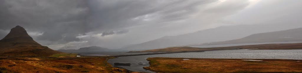
Braving winds that rocked our 4-wheel drive like a cradle, and stinging rain, we persisted in our attempts of photographing the stormy weather near the mountain Kirkjufell, seen here in the background. 


Driving along the Reykjanes coast, south of Reykjavik, we had deceptively good luck with the weather. But, as we explored this light-house at Gardskagi, the weather flipped 180 degrees. And soon after, in the ensuing storm, the incident with the GPS-warning occurred, as we were driving towards Selfoss.


This is what driving in South Iceland feels like - mountains & waterfalls are almost-constant companions along one side of the road, while the other side switches from the sea to lava fields to beaches. Here, sheep, farms & the waterfall Foss-a-Sidu are seen shortly after crossing the tongue-twistingly named Kirkjubaejarklaustur.


One of the tallest waterfalls in Iceland, Skogafoss sprays everybody who dares approach it, accompanied by a deafening crescendo. The waterfall and the mist rising from the spray can be seen from the ring road.


Further along the coast from Skogafoss, the landscape changes, as black-sand beaches make an appearance. The promontory at Dyrholaey offers unhindered views over the black-sand beach Reynisfjara. To the extreme right are the basalt projections, Reynisdrangur. Local lore has it that the projections are two trolls who could not reach land before dawn while on their ship and hence, turned into stone at the first touch of sunrays. Together, these three elements form one of the most distinctive landscapes in South Iceland.


Pocket-sized Vik is an important town in South Iceland, housing just 300 people, seen here on a rainy day from its beach. The solitary building to the right is the town's church. An incomplete rainbow adds some colour to the rain-drenched village.


Bucolic vistas like this are fairly common, with most hills and mountains dotted with moving, white fur-balls – Icelandic sheep. Also seen languorously grazing the sparse winter grass are the very unique Icelandic horses.


Icelandic horses seem to display a keen fashion sense with their fringe-like, windswept manes.


As you head eastwards, the landscape hints at Iceland’s many active and dormant volcanoes. These benign-looking lava fields at Eldhraun belie an unimaginable 18th century catastrophe - An almost-simultaneous eruption of over 135 craters at nearby Laki led to death, destruction and the formation of over 500 sq.km of lava fields. Here, moon-rise paints an eerie hue over the lava fields and the glacier Myrdalsjokull, beneath which lies the active volcano Katla.


Did I say glacier? Sure enough, the landscape abruptly changes once again, to introduce ice into the picture. Right next to Route 1!


Hiking on a glacier - one of my favourite moments in Iceland. Re-learning how to walk strapped with crampons, you struggle to avoid crevasses even as you goggle at marvellous ice formations. The ice-axe is a lifesaver as it adds a much-needed extra leg.


The summit of the glacier Svinafellsjokull left me with the feeling of being on the roof of the world.


The frequency with which your heart skips a beat, it seems like driving in Iceland should come with a health warning. The glacial lagoon Jokulsarlon appears along Route-1 with a suddenness that once again catches you unawares. And this, before you’ve barely recovered from the experience of driving alongside glaciers.


The icebergs here are ideal to play ‘name the shape’ games with; this collection of icebergs forms a rather striking arrow.  Contrary to popular perception, icebergs are not always white; older icebergs are browner as they gather soil and sediment from their movements. The younger the iceberg, the whiter it is.


This turf-roofed wooden church at Hof, Oraefi, near Jokulsarlon, is a classic example of traditional Icelandic architecture and is one of the few surviving buildings in the style.


During my stay at farms across Iceland, other distinct elements I noticed were garden ornaments and dolls, such as these. Their bright colours and ingenious designs brought some cheer to cold, gloomy winter days.


Before moving a little inland in the north, Route-1 winds around Iceland’s craggy east coast, leading to the Eastfjords. More secluded than many other parts of Iceland, the beauty of the fjords leaves you short of breath and adjectives.


The harbour at Djupivogur looks picture-perfect, with colourful fishing boats and yachts moored in impossibly blue waters. Djupivogur, in the Eastfjords, is also known for its buildings dating back to the 18th and 19th centuries.


Standing at the mouth of a fjord, looking at tiny villages scattered around like match-boxes, you feel inconsequential in nature. We headed as far east as Breidalsvik, before the weather changed overnight and forced us back along the southern coast, all the way to Reykjavik.


Curious to know more about Iceland, our trip & our itinerary? Read on:

About Iceland & Our experience:

Itinerary, useful information & tips: